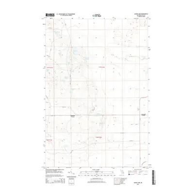
2014 Map of Auger Lake
USGS Topo · Published 2014About this map
Glacial depressions and water bodies dominate the landscape of Columbus Township in the early twenty-first century, characterized by a complex network of small lakes and seasonal drainages. Auger Lake and the nearby Cleveland Cliffs Lake sit at the heart of this terrain, surrounded by numerous smaller basins such as Donut Lake, Ahlman Lake, and Reds Lake. The map reveals a land management history through its nomenclature, with locations like Camp Seven Lake and Camp Five Lake suggesting a legacy of organized camps or industrial outposts in this part of Luce County.
Find a feature on this map
35 named features on this map. Tap any name to fly to it.
Don’t see what you’re looking for? This feature index may not catch every label — zoom into the map to look around manually.
Map Details
Editions of this 2014 Auger Lake Map
This is the sole edition of this map. No revisions or reprints were ever made.
Other maps of this area

1954 · Sault Sainte Marie
USGS Topo · 1:250,000

1956 · Sault Sainte Marie
USGS Topo · 1:250,000

1957 · Sault Sainte Marie
USGS Topo · 1:250,000

1958 · Sault Sainte Marie
USGS Topo · 1:250,000

1962 · Auger Lake
USGS Topo · 1:24,000

1968 · Muskallonge Lake SW
USGS Topo · 1:24,000

1968 · Muskallonge Lake SE
USGS Topo · 1:24,000

1968 · Betsy Lake SW
USGS Topo · 1:24,000
1973 · McMillan
USGS Topo · 1:24,000
1973 · Newberry
USGS Topo · 1:24,000