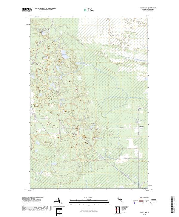
2023 Map of Auger Lake
USGS Topo · Published 2023About this map
Luce County wetlands and timberlands dominate this portion of the Upper Peninsula, characterized by a dense network of forest roads and small, isolated lakes. Auger Lake and the nearby Cleveland Cliffs Lake sit within a landscape defined by industrial and recreational access, linked by routes such as Deer Park Rd and Halfway-Lake Rd. The settlement at Fourmile Corner serves as a primary junction where M-123 and Falls Rd meet, marking the edge of the more heavily wooded interior.
Find a feature on this map
48 named features on this map. Tap any name to fly to it.
Don’t see what you’re looking for? This feature index may not catch every label — zoom into the map to look around manually.
Map Details
Editions of this 2023 Auger Lake Map
This is the sole edition of this map. No revisions or reprints were ever made.
Other maps of this area

1954 · Sault Sainte Marie
USGS Topo · 1:250,000

1956 · Sault Sainte Marie
USGS Topo · 1:250,000

1957 · Sault Sainte Marie
USGS Topo · 1:250,000

1958 · Sault Sainte Marie
USGS Topo · 1:250,000

1962 · Auger Lake
USGS Topo · 1:24,000

1968 · Muskallonge Lake SW
USGS Topo · 1:24,000

1968 · Muskallonge Lake SE
USGS Topo · 1:24,000

1968 · Betsy Lake SW
USGS Topo · 1:24,000
1973 · McMillan
USGS Topo · 1:24,000
1973 · Newberry
USGS Topo · 1:24,000