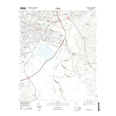
2014 Map of Augusta East
USGS Topo · Published 2014About this map
The Savannah River defines the heart of this 2014 survey, marking the state line between Georgia and South Carolina as it flows past Augusta. On the Georgia side, the urban grid is dense with institutions like Paine College and the Medical College of Georgia, while the riverfront is marked by the Butt Memorial Bridge and Walker Memorial Park. South of the city, the landscape transitions into industrial and municipal utility zones, including the Augusta Regional at Bush Field and the Kimberly Clark Waste Water Basin.
Find a feature on this map
240 named features on this map. Tap any name to fly to it.
Don’t see what you’re looking for? This feature index may not catch every label — zoom into the map to look around manually.
Map Details
Editions of this 2014 Augusta East Map
This is the sole edition of this map. No revisions or reprints were ever made.
Other maps of this area

1892 · Mc Cormick
USGS Topo · 1:125,000

1912 · Mc Cormick
USGS Topo · 1:125,000

1920 · Clarks Hill
USGS Topo · 1:48,000

1921 · Augusta
USGS Topo · 1:62,500

1921 · Clarks Hill
USGS Topo · 1:62,500

1922 · Hephzibah
USGS Topo · 1:62,500

1923 · Warrenville
USGS Topo · 1:48,000

1928 · Warrenville
USGS Topo · 1:62,500

1941 · Clarks Hill
USGS Topo · 1:62,500

1942 · Clarks Hill
USGS Topo · 1:62,500