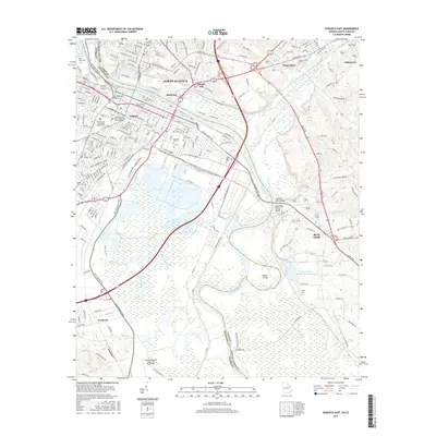
2017 Map of Augusta East
USGS Topo · Published 2017About this map
The Savannah River carves a winding path through this region, serving as the border between Augusta, Georgia, and North Augusta, South Carolina. This landscape is defined by its deep historical roots and the intricate relationship between urban development and the river's floodplains. To the south, the expansive Phinizy Swamp and its associated waterways, like Phinizy Ditch, dominate the lowlands near the Augusta Regional Airport at Bush Field. These wetlands contrast with the dense grid of downtown Augusta, where institutional landmarks such as the Medical Coll of Georgia Augusta Univ and numerous burial grounds, including Magnolia Cem and Cedar Grove Cem, anchor the community's history.
Find a feature on this map
68 named features on this map. Tap any name to fly to it.
Don’t see what you’re looking for? This feature index may not catch every label — zoom into the map to look around manually.
Map Details
Editions of this 2017 Augusta East Map
This is the sole edition of this map. No revisions or reprints were ever made.
Other maps of this area

1892 · Mc Cormick
USGS Topo · 1:125,000

1912 · Mc Cormick
USGS Topo · 1:125,000

1920 · Clarks Hill
USGS Topo · 1:48,000

1921 · Augusta
USGS Topo · 1:62,500

1921 · Clarks Hill
USGS Topo · 1:62,500

1922 · Hephzibah
USGS Topo · 1:62,500

1923 · Warrenville
USGS Topo · 1:48,000

1928 · Warrenville
USGS Topo · 1:62,500

1941 · Clarks Hill
USGS Topo · 1:62,500

1942 · Clarks Hill
USGS Topo · 1:62,500