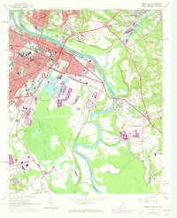
1965 Map of Augusta East
USGS Topo · Published 1973About this map
The Savannah River serves as the central artery for this mid-1960s survey, dividing the urban grid of Augusta from the heights of North Augusta. The map captures a moment of transition where established civic infrastructure, including the University of Georgia Medical College and Union Station, meets the expanding suburbs indicated by later revisions. South of the city, the landscape shifts dramatically into the low-lying Phinizy Swamp and the intricate bends of the Dead River, illustrating the natural floodplains that shaped local development.
Find a feature on this map
57 named features on this map. Tap any name to fly to it.
Don’t see what you’re looking for? This feature index may not catch every label — zoom into the map to look around manually.
Map Details
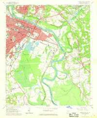
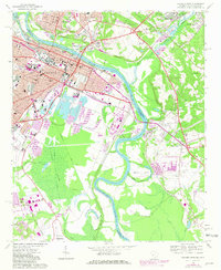
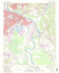
Editions of this 1965 Augusta East Map
4 editions found
Other maps of this area

1892 · Mc Cormick
USGS Topo · 1:125,000

1912 · Mc Cormick
USGS Topo · 1:125,000

1920 · Clarks Hill
USGS Topo · 1:48,000

1921 · Augusta
USGS Topo · 1:62,500

1921 · Clarks Hill
USGS Topo · 1:62,500

1922 · Hephzibah
USGS Topo · 1:62,500

1923 · Warrenville
USGS Topo · 1:48,000

1928 · Warrenville
USGS Topo · 1:62,500

1941 · Clarks Hill
USGS Topo · 1:62,500

1942 · Clarks Hill
USGS Topo · 1:62,500