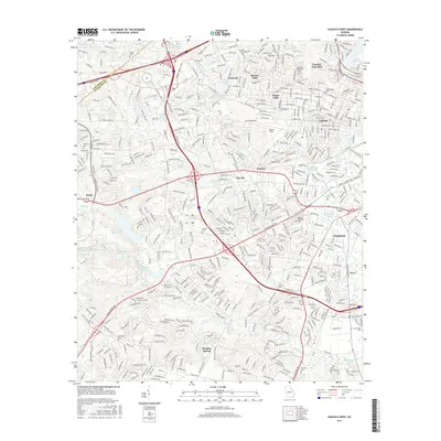
2017 Map of Augusta West
USGS Topo · Published 2017About this map
Augusta and its western suburbs appear as a dense network of residential developments and transportation corridors in this late-2010s survey. Neighborhoods like Forest Hills, Country Club Hills, and Southlands define the suburban expansion, while historical markers remain in the form of numerous family-named burial grounds such as Evans Cem and Newman Cem. The landscape is a mix of urban infrastructure and managed water features, including Lake Olmstead in the northeast and Fort Gordon Reservoir to the southwest.
Find a feature on this map
55 named features on this map. Tap any name to fly to it.
Don’t see what you’re looking for? This feature index may not catch every label — zoom into the map to look around manually.
Map Details
Editions of this 2017 Augusta West Map
This is the sole edition of this map. No revisions or reprints were ever made.
Other maps of this area

1892 · Mc Cormick
USGS Topo · 1:125,000

1912 · Mc Cormick
USGS Topo · 1:125,000

1920 · Clarks Hill
USGS Topo · 1:48,000

1921 · Augusta
USGS Topo · 1:62,500

1921 · Clarks Hill
USGS Topo · 1:62,500

1922 · Hephzibah
USGS Topo · 1:62,500

1923 · Warrenville
USGS Topo · 1:48,000

1928 · Warrenville
USGS Topo · 1:62,500

1941 · Clarks Hill
USGS Topo · 1:62,500

1942 · Clarks Hill
USGS Topo · 1:62,500