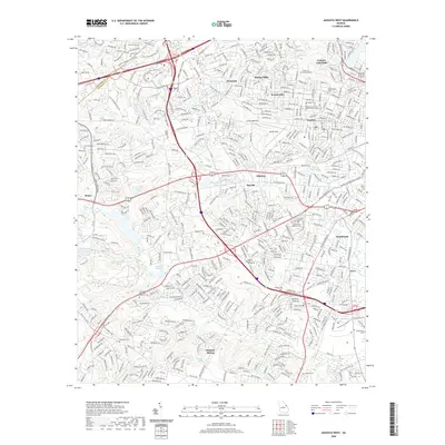
2020 Map of Augusta West
USGS Topo · Published 2020About this map
Augusta and its western suburbs define this modern landscape, where extensive medical and educational infrastructure meets established residential neighborhoods. Significant institutional landmarks include the VA Hospital, GA Regional Hospital, and the campus of Augusta Technical College. The terrain is marked by a complex network of suburban drainage, featuring local water bodies such as Lombard Millpond, Rocky Cr, and Kissing-Bower Lake. Genealogists will find a high density of burial sites across this quadrangle, ranging from the expansive Westover Memorial Park and Hillcrest Cemetery to smaller family-named locations like Chavous Cem, Steadman Cem, and Morgan Cem. Transportation is dominated by the intersection of I-20 and I-520, which carves through the suburban fabric near Daniel Field.
Find a feature on this map
48 named features on this map. Tap any name to fly to it.
Don’t see what you’re looking for? This feature index may not catch every label — zoom into the map to look around manually.
Map Details
Editions of this 2020 Augusta West Map
This is the sole edition of this map. No revisions or reprints were ever made.
Other maps of this area

1892 · Mc Cormick
USGS Topo · 1:125,000

1912 · Mc Cormick
USGS Topo · 1:125,000

1920 · Clarks Hill
USGS Topo · 1:48,000

1921 · Augusta
USGS Topo · 1:62,500

1921 · Clarks Hill
USGS Topo · 1:62,500

1922 · Hephzibah
USGS Topo · 1:62,500

1923 · Warrenville
USGS Topo · 1:48,000

1928 · Warrenville
USGS Topo · 1:62,500

1941 · Clarks Hill
USGS Topo · 1:62,500

1942 · Clarks Hill
USGS Topo · 1:62,500