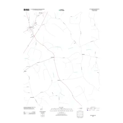
2013 Map of Aulander
USGS Topo · Published 2013About this map
Aulander serves as the primary hub for this agricultural landscape in Bertie County, where a dense network of local roads radiates from the town center. The geography is defined by extensive lowlands, most notably the Beaverdam Swamp and Connaritsa Swamp, which thread through the rural countryside. Small settlements like Millennium to the north and Hexlena to the east highlight the historical pattern of crossroads communities. Of particular interest to local historians is the southern reach of the quadrangle near Francis Mill, where the intersection of Connaritsa Swamp and Eason Swamp shapes the terrain. The map's detailed documentation of rural infrastructure, including Early Station Rd and Brick Mill Rd, offers a clear view of the transportation corridors that have connected these farming and milling outposts since the early 20th century.
Find a feature on this map
55 named features on this map. Tap any name to fly to it.
Don’t see what you’re looking for? This feature index may not catch every label — zoom into the map to look around manually.
Map Details
Editions of this 2013 Aulander Map
This is the sole edition of this map. No revisions or reprints were ever made.
Other maps of this area

1908 · Winton
USGS Topo · 1:62,500

1953 · Norfolk
USGS Topo · 1:250,000

1972 · Republican
USGS Topo · 1:24,000

1972 · Woodville
USGS Topo · 1:24,000

1972 · Aulander
USGS Topo · 1:24,000

1973 · Kelford
USGS Topo · 1:24,000

1977 · Union
USGS Topo · 1:24,000

1977 · Woodland
USGS Topo · 1:24,000
1981 · Windsor North
USGS Topo · 1:24,000

1982 · Powellsville
USGS Topo · 1:24,000