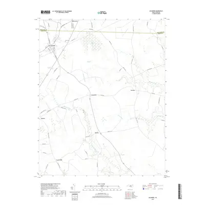
2019 Map of Aulander
USGS Topo · Published 2019About this map
Aulander and the surrounding coastal plain of the Hertford Co and Bertie Co border are characterized by an intricate network of wetlands and small agricultural settlements. The landscape is defined by its distinct inland wetlands, notably Hearts Delight Pocosin and Beaverdam Pocosin, which influence the local road patterns. These pocosins, along with drainage systems like Connaritsa Swamp and Eason Swamp, create a patchwork of wooded bogs and arable land.
Find a feature on this map
52 named features on this map. Tap any name to fly to it.
Don’t see what you’re looking for? This feature index may not catch every label — zoom into the map to look around manually.
Map Details
Editions of this 2019 Aulander Map
This is the sole edition of this map. No revisions or reprints were ever made.
Other maps of this area

1908 · Winton
USGS Topo · 1:62,500

1953 · Norfolk
USGS Topo · 1:250,000

1972 · Republican
USGS Topo · 1:24,000

1972 · Woodville
USGS Topo · 1:24,000

1972 · Aulander
USGS Topo · 1:24,000

1973 · Kelford
USGS Topo · 1:24,000

1977 · Union
USGS Topo · 1:24,000

1977 · Woodland
USGS Topo · 1:24,000
1981 · Windsor North
USGS Topo · 1:24,000

1982 · Powellsville
USGS Topo · 1:24,000