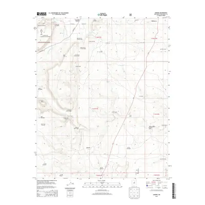
2013 Map of Aurora
USGS Topo · Published 2013About this map
Gonzales Ranch and Villanueva anchor this high-desert landscape in San Miguel County, where the terrain is defined by a dense network of canyons and mesas. The map documents a traditional New Mexican land-use pattern, featuring isolated ranching outposts such as Benevides Ranch, Snyder Ranch, and Pablo Sena Ranch. The topography is dominated by dramatic relief, including Cerro Tejano and the sprawling Mesa Sacatosa, with the northwestern corner protected by the Santa Fe National Forest. Water is a seasonal and precious resource here, marked by drainage systems like Arroyo de los Diegos and Arroyo Calaveras. The settlement of Aurora sits centrally among these features, illustrating the persistence of small communities in the rugged corridor along NM-3. Notable landmarks like the Post Office in the northwest and East Windmill provide specific points of interest for those studying the regional infrastructure and genealogy of this high-elevation territory.
Find a feature on this map
45 named features on this map. Tap any name to fly to it.
Don’t see what you’re looking for? This feature index may not catch every label — zoom into the map to look around manually.
Map Details
Editions of this 2013 Aurora Map
This is the sole edition of this map. No revisions or reprints were ever made.
Other maps of this area

1890 · Bernal
USGS Topo · 1:125,000

1891 · Bernal
USGS Topo · 1:125,000

1894 · Bernal
USGS Topo · 1:125,000

1894 · Lamy
USGS Topo · 1:125,000

1954 · Santa Fe
USGS Topo · 1:250,000

1958 · Santa Fe
USGS Topo · 1:250,000

1960 · Villanueva
USGS Topo · 1:62,500

1963 · Jacinto Mesa
USGS Topo · 1:24,000

1963 · Aurora
USGS Topo · 1:24,000
1963 · Potrillo Hill
USGS Topo · 1:24,000