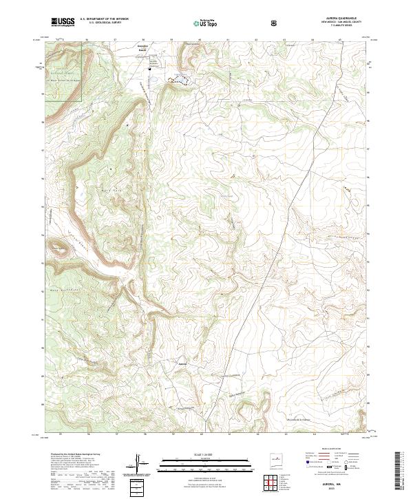
2023 Map of Aurora
USGS Topo · Published 2023About this map
Gonzales Ranch and the small settlement of Aurora anchor this high-altitude landscape in San Miguel County, where the eastern edges of the Santa Fe National Forest meet a complex series of mesas and drainages. The topography is defined by prominent elevations like Mesa Sacatosa and Mesa Sola, which are carved by a dense network of seasonal watercourses including Cañon de la Primera Agua and Arroyo Sanchez. For those researching local heritage, the San Isidro de Labador Church Cem stands as a central landmark near the northern boundary.
Find a feature on this map
40 named features on this map. Tap any name to fly to it.
Don’t see what you’re looking for? This feature index may not catch every label — zoom into the map to look around manually.
Map Details
Editions of this 2023 Aurora Map
This is the sole edition of this map. No revisions or reprints were ever made.
Other maps of this area

1890 · Bernal
USGS Topo · 1:125,000

1891 · Bernal
USGS Topo · 1:125,000

1894 · Bernal
USGS Topo · 1:125,000

1894 · Lamy
USGS Topo · 1:125,000

1954 · Santa Fe
USGS Topo · 1:250,000

1958 · Santa Fe
USGS Topo · 1:250,000

1960 · Villanueva
USGS Topo · 1:62,500

1963 · Jacinto Mesa
USGS Topo · 1:24,000

1963 · Aurora
USGS Topo · 1:24,000
1963 · Potrillo Hill
USGS Topo · 1:24,000