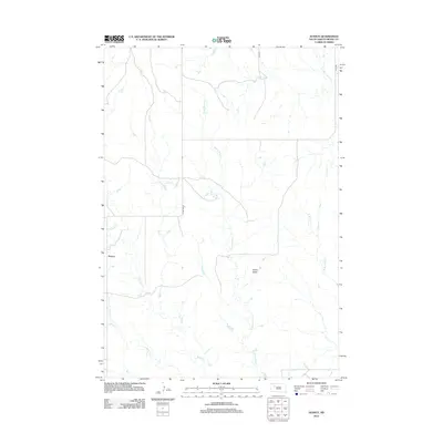
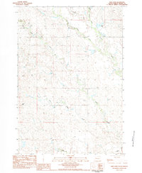
2012 Map of Avance
USGS Topo · Published 2012About this map
Avance serves as a central point of settlement in this part of Meade County, where the landscape is defined by a dendritic network of prairie drainages. The area is dominated by the prominence of Stony Butte, a high point that overlooks the winding courses of Stony Butte Cr and Wolf Cr. This 2012 survey illustrates the remote rural infrastructure of the South Dakota plains, where sections are divided by gravel routes and local roads like Co HWY MC-37 and 194th PL. The hydrology of the region is notably complex, featuring numerous named branches such as Brushy Cr, Jimmy Cr, and Johnny Cr that channel water toward larger systems like W Br Turtle Cr and Red Scaffold Cr.
Find a feature on this map
12 named features on this map. Tap any name to fly to it.
Don’t see what you’re looking for? This feature index may not catch every label — zoom into the map to look around manually.
Map Details
Editions of this 2012 Avance Map
This is the sole edition of this map. No revisions or reprints were ever made.
Other maps of this area

1952 · Deep Creek SE
USGS Topo · 1:24,000

1953 · Rapid City
USGS Topo · 1:250,000

1954 · Lemmon
USGS Topo · 1:250,000

1957 · Lemmon
USGS Topo · 1:250,000

1957 · Rapid City
USGS Topo · 1:250,000
1983 · Faith
USGS Topo · 1:24,000

1983 · Lemmon Butte
USGS Topo · 1:24,000
1983 · Avance SE
USGS Topo · 1:24,000
1983 · Avance
USGS Topo · 1:24,000
1983 · Reed Dam
USGS Topo · 1:24,000