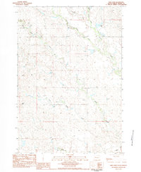
1983 Map of Reed Dam
USGS Topo · Published 1984About this map
Stony Butte Creek and Brushy Creek converge in this western Meade County landscape, where the seasonal drainage network shapes the geography of the high plains. The map centers on the namesake Reed Dam, a local water landmark situated along the upper reaches of Brushy Creek. This area, largely defined by ranching and resource extraction in the early 1980s, shows a sparse but vital human footprint. The settlement at Cooper and the United Sch serve as the primary community hubs, while numerous locations marked simply as Well indicate the critical importance of subterranean water access in this semi-arid terrain. The drainage patterns of West Middle Creek and Middle Creek dominate the central and southern portions of the quadrangle, illustrating the complex erosional features characteristic of the region's topography.
Find a feature on this map
11 named features on this map. Tap any name to fly to it.
Don’t see what you’re looking for? This feature index may not catch every label — zoom into the map to look around manually.
Map Details
Editions of this 1983 Reed Dam Map
This is the sole edition of this map. No revisions or reprints were ever made.
Other maps of this area

1953 · Rapid City
USGS Topo · 1:250,000

1957 · Rapid City
USGS Topo · 1:250,000

1983 · Lemmon Butte
USGS Topo · 1:24,000
1983 · Avance SE
USGS Topo · 1:24,000
1983 · Avance
USGS Topo · 1:24,000
1983 · Lemmon Creek
USGS Topo · 1:24,000
1983 · Durkee Lake
USGS Topo · 1:24,000

1983 · Marcus
USGS Topo · 1:24,000
1983 · Opal East SE
USGS Topo · 1:24,000
1983 · Thompson Lake
USGS Topo · 1:24,000