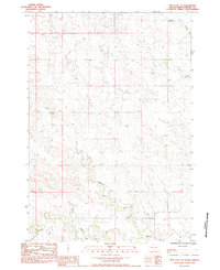
1983 Map of Opal East SE
USGS Topo · Published 1984About this map
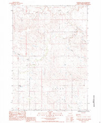
Beaver Creek and its complex drainage network define the topography of this Meade County landscape as it appeared in the early 1980s. The map illustrates a rural environment characterized by small, isolated settlements and crossing points such as Welt, Mole, and Corner. The presence of several named waterways, including the East Branch Beaver Creek, Sulphur Creek, and the headwaters of Cherry Cr, highlights the importance of seasonal water management in this high plains region. Small Dam structures scattered along these drainages suggest a landscape engineered for ranching and livestock. For the local historian, the map identifies specific locations like Repocci and Middle Creek that provide markers of late-20th-century land use. This provisional survey captures the transition between the rolling uplands and the creek bottoms that have shaped the settlement patterns of western South Dakota.
Find a feature on this map
13 named features on this map. Tap any name to fly to it.
Don’t see what you’re looking for? This feature index may not catch every label — zoom into the map to look around manually.
Map Details
Editions of this 1983 Opal East SE Map
This is the sole edition of this map. No revisions or reprints were ever made.
Other maps of this area

1953 · Rapid City
USGS Topo · 1:250,000

1957 · Rapid City
USGS Topo · 1:250,000

1983 · Whiteman Owl NW
USGS Topo · 1:24,000

1983 · Lemmon Butte
USGS Topo · 1:24,000
1983 · Avance
USGS Topo · 1:24,000
1983 · Opal East
USGS Topo · 1:24,000

1983 · Opal East SW
USGS Topo · 1:24,000
1983 · Reed Dam
USGS Topo · 1:24,000

1983 · Marcus
USGS Topo · 1:24,000
1983 · Thompson Lake
USGS Topo · 1:24,000