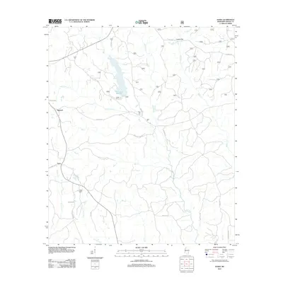
2012 Map of Avera
USGS Topo · Published 2012About this map
Turkey Fork Reservoir centers this portion of Greene County, Mississippi, where the landscape is defined by an intricate network of creeks and branches. The settlement of Avera is situated in the southwest, while Bothwell and the small community of Carson City are located to the north. Local history and genealogy are anchored by family-named sites and burial grounds such as James Cem, Indian Hill Cem, and the Mutual Rights Cem near the banks of Picayune Cr. The terrain rises at Indian Hill, which overlooks the convergence of Indian Camp Cr and Big Cr. Rural transportation is dominated by local routes like Jones McLain Rd and Perrydale Rd, reflecting a landscape dedicated to timber and small-scale agriculture. The presence of Kittrell Mill Cr suggests a legacy of early industry along the water before the modern reservoir was established.
Find a feature on this map
38 named features on this map. Tap any name to fly to it.
Don’t see what you’re looking for? This feature index may not catch every label — zoom into the map to look around manually.
Map Details
Editions of this 2012 Avera Map
This is the sole edition of this map. No revisions or reprints were ever made.
Other maps of this area

1947 · Beaumont
USGS Topo · 1:62,500

1949 · Beaumont
USGS Topo · 1:62,500

1953 · Hattiesburg
USGS Topo · 1:250,000

1958 · Hattiesburg
USGS Topo · 1:250,000

1963 · Brewer
USGS Topo · 1:24,000

1964 · Knobtown
USGS Topo · 1:24,000

1964 · Clark
USGS Topo · 1:24,000

1964 · Mulberry
USGS Topo · 1:24,000

1964 · Avera
USGS Topo · 1:24,000

1964 · Piave
USGS Topo · 1:24,000