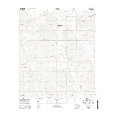
2015 Map of Avera
USGS Topo · Published 2015About this map
DeSoto National Forest dominates much of this landscape, where the headwaters of numerous creeks converge in southeastern Mississippi. The central settlement of Avera serves as a local hub near the intersection of several rural routes including Old MS 63 and Pleasant Hill Rd. Significant water features like the Turkey Fork Reservoir and the winding Turkey-Fork stream illustrate the drainage patterns of the region, while smaller hamlets such as Carson City and Bothwell are situated along the forest boundary. For those tracing family histories or early land use, the map identifies specific local landmarks including Mutual Rights Cem and James Cem. The landscape is a network of named logging and access roads, such as Indian Hill Rd and Station Loop, which carve through the dense woodlands and connect isolated homesteads to the primary thoroughfares.
Find a feature on this map
53 named features on this map. Tap any name to fly to it.
Don’t see what you’re looking for? This feature index may not catch every label — zoom into the map to look around manually.
Map Details
Editions of this 2015 Avera Map
This is the sole edition of this map. No revisions or reprints were ever made.
Other maps of this area

1947 · Beaumont
USGS Topo · 1:62,500

1949 · Beaumont
USGS Topo · 1:62,500

1953 · Hattiesburg
USGS Topo · 1:250,000

1958 · Hattiesburg
USGS Topo · 1:250,000

1963 · Brewer
USGS Topo · 1:24,000

1964 · Knobtown
USGS Topo · 1:24,000

1964 · Clark
USGS Topo · 1:24,000

1964 · Mulberry
USGS Topo · 1:24,000

1964 · Avera
USGS Topo · 1:24,000

1964 · Piave
USGS Topo · 1:24,000