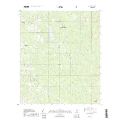
2021 Map of Avera
USGS Topo · Published 2021About this map
De Soto National Forest dominates much of the landscape in this portion of Greene County, where the terrain is defined by a dense network of tributaries including Big Creek and Turkey Fork. The settlement of Avera serves as a local anchor near the junction of Pleasant Hill Rd and Old Hwy 63, while the small community of Bothwell lies to the northwest. For those tracing family histories, the map identifies several significant burial sites, including Indian Hill Cem, James Cem, and Mutual Rights Cem. The area is interlaced with named local roads like George Williams Rd and Milton Dunnam Rd, reflecting a rural infrastructure built around forestry and small-scale agriculture. The presence of Mitchell Mill Cr points to the historical importance of local waterpower in this part of Mississippi.
Find a feature on this map
46 named features on this map. Tap any name to fly to it.
Don’t see what you’re looking for? This feature index may not catch every label — zoom into the map to look around manually.
Map Details
Editions of this 2021 Avera Map
This is the sole edition of this map. No revisions or reprints were ever made.
Other maps of this area

1947 · Beaumont
USGS Topo · 1:62,500

1949 · Beaumont
USGS Topo · 1:62,500

1953 · Hattiesburg
USGS Topo · 1:250,000

1958 · Hattiesburg
USGS Topo · 1:250,000

1963 · Brewer
USGS Topo · 1:24,000

1964 · Knobtown
USGS Topo · 1:24,000

1964 · Clark
USGS Topo · 1:24,000

1964 · Mulberry
USGS Topo · 1:24,000

1964 · Avera
USGS Topo · 1:24,000

1964 · Piave
USGS Topo · 1:24,000