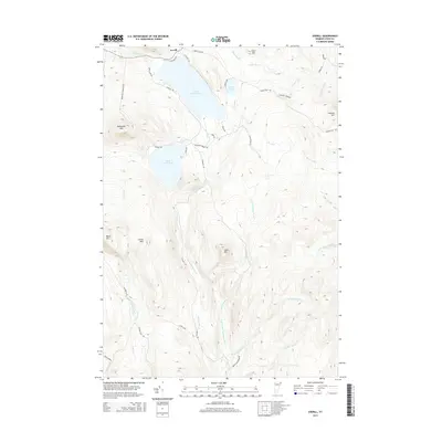
2015 Map of Averill
USGS Topo · Published 2015About this map
Great Averill Pond and Little Averill Pond dominate this Northeast Kingdom landscape, marking the headwaters of the regional drainage system. The settlement of Averill sits at the northern edge of the water, where the terrain transitions into the high peaks of the Essex County wilderness. High points like Brousseau Mtn and Canaan Hill overlook a network of logging roads and early paths, including Averill Lake Rd and Jackson Rd.
Find a feature on this map
46 named features on this map. Tap any name to fly to it.
Don’t see what you’re looking for? This feature index may not catch every label — zoom into the map to look around manually.
Map Details
Editions of this 2015 Averill Map
This is the sole edition of this map. No revisions or reprints were ever made.
Other maps of this area

1924 · Island Pond
USGS Topo · 1:48,000

1926 · Island Pond
USGS Topo · 1:62,500

1929 · Averill
USGS Topo · 1:62,500

1949 · Jackman
USGS Topo · 1:250,000

1950 · Lewiston
USGS Topo · 1:250,000

1953 · Island Pond
USGS Topo · 1:62,500

1953 · Averill
USGS Topo · 1:62,500

1956 · Lewiston
USGS Topo · 1:250,000

1961 · Lewiston
USGS Topo · 1:250,000

1962 · Lewiston
USGS Topo · 1:250,000