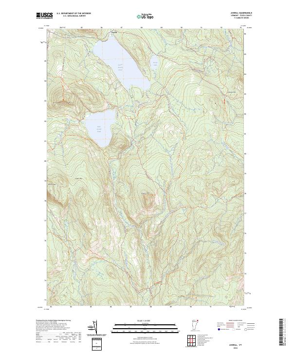
2024 Map of Averill
USGS Topo · Published 2024About this map
Great Averill Pond and Little Averill Pond anchor this landscape in Essex County, defined by its complex network of glacial lakes and mountain peaks. The northern settlement of Averill sits near the Canadian border, while the southern reaches are preserved within the Silvio O Conte National Fish and Wildlife Refuge. The drainage patterns are distinct, with the East Branch Nulhegan River and Black Branch Nulhegan River flowing south through the highlands. Steep elevations like Brousseau Mtn and Sable Mtn rise sharply above narrow valley roads, reflecting the isolated, timber-driven character of the Northeast Kingdom. A network of logging routes and lakeside drives, such as Little Averill Lake Rd and Hatchery Brook Rd, provides the primary access to these remote waters and surrounding timberlands.
Find a feature on this map
42 named features on this map. Tap any name to fly to it.
Don’t see what you’re looking for? This feature index may not catch every label — zoom into the map to look around manually.
Map Details
Editions of this 2024 Averill Map
This is the sole edition of this map. No revisions or reprints were ever made.
Other maps of this area

1924 · Island Pond
USGS Topo · 1:48,000

1926 · Island Pond
USGS Topo · 1:62,500

1929 · Averill
USGS Topo · 1:62,500

1949 · Jackman
USGS Topo · 1:250,000

1950 · Lewiston
USGS Topo · 1:250,000

1953 · Island Pond
USGS Topo · 1:62,500

1953 · Averill
USGS Topo · 1:62,500

1956 · Lewiston
USGS Topo · 1:250,000

1961 · Lewiston
USGS Topo · 1:250,000

1962 · Lewiston
USGS Topo · 1:250,000