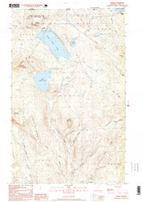
1995 Map of Averill
USGS Topo · Published 1999About this map
Great Averill Pond and Little Averill Pond dominate this Northeast Kingdom landscape, reflecting a remote wilderness character shaped by glacial geography and the timber industry. Located along the Canada-United States border, the terrain is defined by prominent peaks like Sable Mountain, Brousseau Mtn, and Averill Mountain. The drainage patterns of the Nulhegan River system, including the East Branch Nulhegan River and Black Branch Nulhegan River, suggest a region historically oriented toward logging, evidenced by the presence of numbered outposts such as Camp No 21 and Camp No 11. Protective management is indicated by the Averill Mountain State Wildlife Management Area, which covers the northwestern heights. This survey captures a moment when the area remained largely undeveloped, consisting of scattered camps and seasonal dwellings near the shores of Forest Lake and Wallace Pond.
Find a feature on this map
41 named features on this map. Tap any name to fly to it.
Don’t see what you’re looking for? This feature index may not catch every label — zoom into the map to look around manually.
Map Details
Editions of this 1995 Averill Map
This is the sole edition of this map. No revisions or reprints were ever made.
Other maps of this area

1924 · Island Pond
USGS Topo · 1:48,000

1926 · Island Pond
USGS Topo · 1:62,500

1929 · Averill
USGS Topo · 1:62,500

1949 · Jackman
USGS Topo · 1:250,000

1950 · Lewiston
USGS Topo · 1:250,000

1953 · Island Pond
USGS Topo · 1:62,500

1953 · Averill
USGS Topo · 1:62,500

1956 · Lewiston
USGS Topo · 1:250,000

1961 · Lewiston
USGS Topo · 1:250,000

1962 · Lewiston
USGS Topo · 1:250,000