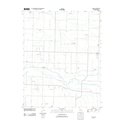
2011 Map of Avilla
USGS Topo · Published 2011About this map
Spring River meanders across this landscape of Jasper County, defining the local geography alongside White Oak Creek and the Dry Fork. The settlement of Avilla serves as a primary anchor in the eastern portion of the map, while smaller locales like Forest Mills and Melugin indicate the historical distribution of rural centers in the region. The map reveals an area where agricultural land use is punctuated by numerous family and community burial grounds, such as Summerset Cemetery, Fasken Cemetery, and Arthur Cemetery.
Find a feature on this map
67 named features on this map. Tap any name to fly to it.
Don’t see what you’re looking for? This feature index may not catch every label — zoom into the map to look around manually.
Map Details
Editions of this 2011 Avilla Map
This is the sole edition of this map. No revisions or reprints were ever made.
Other maps of this area

1886 · Carthage
USGS Topo · 1:125,000

1894 · Carthage
USGS Topo · 1:125,000

1921 · Sarcoxie
USGS Topo · 1:62,500

1947 · Joplin
USGS Topo · 1:250,000

1949 · Joplin
USGS Topo · 1:250,000

1954 · Joplin
USGS Topo · 1:250,000

1958 · Joplin
USGS Topo · 1:250,000

1959 · Joplin
USGS Topo · 1:250,000
1962 · Jasper
USGS Topo · 1:24,000
1962 · Dudenville
USGS Topo · 1:24,000