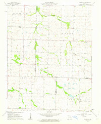
1962 Map of Dudenville
USGS Topo · Published 1963About this map
Dudenville and Maple Grove anchor this Southwest Missouri landscape at the crossroads of Dade, Jasper, and Lawrence counties. The survey depicts a rural community defined by its watercourses and social centers, with the North Fork Spring River and Coon Creek carving through the agricultural terrain. A snapshot of local life in the early 1960s is preserved through the locations of the Victory Community Center, Unity Sch, and Kistler Cem.
Find a feature on this map
20 named features on this map. Tap any name to fly to it.
Don’t see what you’re looking for? This feature index may not catch every label — zoom into the map to look around manually.
Map Details
Editions of this 1962 Dudenville Map
2 editions found
Other maps of this area

1886 · Greenfield
USGS Topo · 1:125,000

1886 · Carthage
USGS Topo · 1:125,000

1888 · Greenfield
USGS Topo · 1:125,000

1894 · Carthage
USGS Topo · 1:125,000

1921 · Stotts City
USGS Topo · 1:62,500

1921 · Sarcoxie
USGS Topo · 1:62,500

1947 · Joplin
USGS Topo · 1:250,000

1949 · Joplin
USGS Topo · 1:250,000

1954 · Springfield
USGS Topo · 1:250,000

1954 · Joplin
USGS Topo · 1:250,000