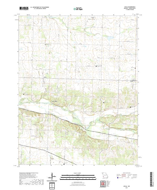
2021 Map of Avilla
USGS Topo · Published 2021About this map
The Spring River meanders across this corner of Jasper County, defining a landscape of agricultural sections and scattered homesteads north of the town of Avilla. This 2021 study documents a region deeply tied to its rural roots and transportation history, featuring several small airstrips including the Route 66 Airfield, Sunderland Airport, and Nimsick Airport. The settlement of Forest Mills sits near the riverbanks, where the terrain breaks into more complex contouring compared to the steady grids of the northern prairie.
Find a feature on this map
65 named features on this map. Tap any name to fly to it.
Don’t see what you’re looking for? This feature index may not catch every label — zoom into the map to look around manually.
Map Details
Editions of this 2021 Avilla Map
This is the sole edition of this map. No revisions or reprints were ever made.
Other maps of this area

1886 · Carthage
USGS Topo · 1:125,000

1894 · Carthage
USGS Topo · 1:125,000

1921 · Sarcoxie
USGS Topo · 1:62,500

1947 · Joplin
USGS Topo · 1:250,000

1949 · Joplin
USGS Topo · 1:250,000

1954 · Joplin
USGS Topo · 1:250,000

1958 · Joplin
USGS Topo · 1:250,000

1959 · Joplin
USGS Topo · 1:250,000
1962 · Jasper
USGS Topo · 1:24,000
1962 · Dudenville
USGS Topo · 1:24,000