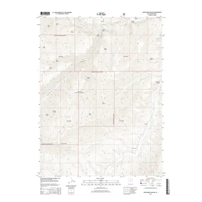
2014 Map of Avintaquin Canyon
USGS Topo · Published 2014About this map
Ashley National Forest dominates this high-altitude landscape in Duchesne County, where deep incisions like Avintaquin Canyon and Bumper Canyon define the drainage patterns of the western Uintah Basin. The map captures a high-country ranching economy during the early 21st century, with localized hubs of activity at Remund Ranch, Baum Ranch, and Peatross Ranch along the watercourses. These family-named landmarks are connected by primitive routes like Timber Canyon Rd, which traverses the ridge between Rough Canyon and Lion Hollow. Notable water sources including Sayers Spring and the Strawberry River provide the vital infrastructure for this isolated terrain, while prominent landmarks like Timber Point offer vantage points over the complex network of draws and hollows that feed into Avintaquin Cr.
Find a feature on this map
32 named features on this map. Tap any name to fly to it.
Don’t see what you’re looking for? This feature index may not catch every label — zoom into the map to look around manually.
Map Details
Editions of this 2014 Avintaquin Canyon Map
This is the sole edition of this map. No revisions or reprints were ever made.
Other maps of this area

1885 · Uinta
USGS Topo · 1:250,000

1886 · Price River
USGS Topo · 1:250,000

1896 · Price River
USGS Topo · 1:250,000

1954 · Salt Lake City
USGS Topo · 1:250,000

1956 · Price
USGS Topo · 1:250,000

1958 · Salt Lake City
USGS Topo · 1:250,000

1960 · Salt Lake City
USGS Topo · 1:250,000

1960 · Price
USGS Topo · 1:250,000

1962 · Price
USGS Topo · 1:250,000

1962 · Deep Creek Canyon
USGS Topo · 1:24,000