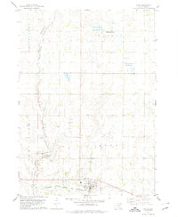
1978 Map of Avon
USGS Topo · Published 1979About this map
The town of Avon serves as the primary hub in this late 1970s landscape, situated along the southern edge where the Chicago Milwaukee St Paul and Pacific railroad runs east-to-west. The terrain is defined by the drainage of Choteau Creek and its tributary Dry Choteau Creek, which mark the boundary between Charles Mix and Bon Homme counties. A significant portion of the northern area is dedicated to conservation, notably the National Waterfowl Production Area and the waters of Meiers Lake.
Find a feature on this map
20 named features on this map. Tap any name to fly to it.
Don’t see what you’re looking for? This feature index may not catch every label — zoom into the map to look around manually.
Map Details
Editions of this 1978 Avon Map
This is the sole edition of this map. No revisions or reprints were ever made.
Other maps of this area

1898 · Olivet
USGS Topo · 1:125,000

1955 · Sioux City
USGS Topo · 1:250,000

1955 · Sioux Falls
USGS Topo · 1:250,000

1955 · Mitchell
USGS Topo · 1:250,000

1955 · O'Neill
USGS Topo · 1:250,000

1958 · Sioux City
USGS Topo · 1:250,000

1958 · Sioux Falls
USGS Topo · 1:250,000

1959 · O'Neill
USGS Topo · 1:250,000

1959 · Sioux City
USGS Topo · 1:250,000

1959 · Mitchell
USGS Topo · 1:250,000