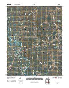
2010 Map of Aylett
USGS Topo · Published 2010About this map
The Mattaponi River carves a winding path through this region of King and Queen County, defining a landscape traditionally shaped by water access and agriculture. The riverbanks are dotted with historic riverfront sites such as Old Hall Landing, Jones Landing, and Pointers Landing, reflecting an era when these points were vital for transport and trade. Inland, the community of Saint Stephens Church stands as a focal point near the intersection of several local roads.
Find a feature on this map
64 named features on this map. Tap any name to fly to it.
Don’t see what you’re looking for? This feature index may not catch every label — zoom into the map to look around manually.
Map Details
Editions of this 2010 Aylett Map
This is the sole edition of this map. No revisions or reprints were ever made.
Other maps of this area

1918 · Tappahannock
USGS Topo · 1:62,500

1918 · Aylett
USGS Topo · 1:62,500

1919 · New Kent
USGS Topo · 1:62,500

1919 · Tappahannock
USGS Topo · 1:62,500

1920 · King William
USGS Topo · 1:62,500

1933 · Aylett
USGS Topo · 1:62,500

1943 · Richmond
USGS Topo · 1:250,000

1944 · Mount Landing
USGS Topo · 1:31,680
1944 · Howertons
USGS Topo · 1:24,000
1945 · Howertons
USGS Topo · 1:31,680