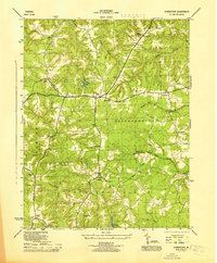
1945 Map of Howertons
USGS Topo · Published 1945About this map
The boundary between Essex and King and Queen counties is defined here by the extensive wetlands of Dragon Swamp and Dragon Run. This 1940s landscape is characterized by its rural infrastructure, featuring integrated community centers like Beulah Ch and Sch and John Moncure Ch and Sch. These dual-purpose buildings reflect the mid-century social fabric of Virginia’s Tidewater region, where local churches and schools served as the primary anchors for small settlements.
Find a feature on this map
41 named features on this map. Tap any name to fly to it.
Don’t see what you’re looking for? This feature index may not catch every label — zoom into the map to look around manually.
Map Details
Editions of this 1945 Howertons Map
This is the sole edition of this map. No revisions or reprints were ever made.
Other maps of this area

1918 · Tappahannock
USGS Topo · 1:62,500

1918 · Aylett
USGS Topo · 1:62,500

1919 · New Kent
USGS Topo · 1:62,500

1919 · Tappahannock
USGS Topo · 1:62,500

1920 · King William
USGS Topo · 1:62,500

1933 · Aylett
USGS Topo · 1:62,500

1943 · Richmond
USGS Topo · 1:250,000

1944 · Mount Landing
USGS Topo · 1:31,680

1944 · Tappahannock
USGS Topo · 1:31,680

1944 · Dunnsville
USGS Topo · 1:31,680