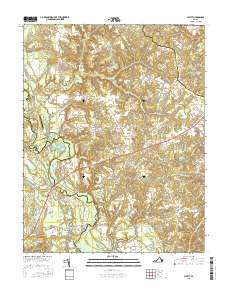
2016 Map of Aylett
USGS Topo · Published 2016About this map
The Mattaponi River winds through the heart of this coastal plain landscape, serving as the primary geographical anchor for several small communities and historical landings. At the river crossing sits Aylett, a settlement with deep roots in the region's transport and milling history, evidenced by nearby Aylett Mill and Aylett Pond. The terrain is defined by a series of significant wetlands and drainage systems such as Georges Swamp, London Swamp, and Pattie Swamp RD, which highlight the low-lying, water-dominant nature of the tidewater area. Further inland, smaller named locales like Biscoe, Rosespout, and Central Garage dot the map along established road corridors. Historical river features including Walker Bar and Robinson Bar reflect the importance of the Mattaponi's shifting channels to local navigation and property boundaries.
Find a feature on this map
74 named features on this map. Tap any name to fly to it.
Don’t see what you’re looking for? This feature index may not catch every label — zoom into the map to look around manually.
Map Details
Editions of this 2016 Aylett Map
This is the sole edition of this map. No revisions or reprints were ever made.
Other maps of this area

1918 · Tappahannock
USGS Topo · 1:62,500

1918 · Aylett
USGS Topo · 1:62,500

1919 · New Kent
USGS Topo · 1:62,500

1919 · Tappahannock
USGS Topo · 1:62,500

1920 · King William
USGS Topo · 1:62,500

1933 · Aylett
USGS Topo · 1:62,500

1943 · Richmond
USGS Topo · 1:250,000

1944 · Mount Landing
USGS Topo · 1:31,680
1944 · Howertons
USGS Topo · 1:24,000
1945 · Howertons
USGS Topo · 1:31,680