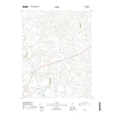
2019 Map of Aylett
USGS Topo · Published 2019About this map
The Mattaponi River carves a winding path through this corner of the Virginia Tidewater, serving as the primary boundary between King William and King Queen counties. The village of Aylett sits at a historic crossing point, supported by nearby sites like Aylett Mill and Aylett Pond. The landscape is defined by its water-driven history, with numerous impoundments and swamps such as Fleets Millpond, Millers Pond, and Georges Swamp draining into the river system.
Find a feature on this map
81 named features on this map. Tap any name to fly to it.
Don’t see what you’re looking for? This feature index may not catch every label — zoom into the map to look around manually.
Map Details
Editions of this 2019 Aylett Map
This is the sole edition of this map. No revisions or reprints were ever made.
Other maps of this area

1918 · Tappahannock
USGS Topo · 1:62,500

1918 · Aylett
USGS Topo · 1:62,500

1919 · New Kent
USGS Topo · 1:62,500

1919 · Tappahannock
USGS Topo · 1:62,500

1920 · King William
USGS Topo · 1:62,500

1933 · Aylett
USGS Topo · 1:62,500

1943 · Richmond
USGS Topo · 1:250,000

1944 · Mount Landing
USGS Topo · 1:31,680
1944 · Howertons
USGS Topo · 1:24,000
1945 · Howertons
USGS Topo · 1:31,680