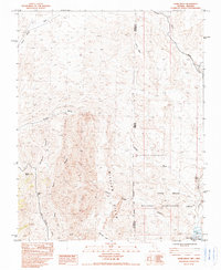
1983 Map of Azure Ridge
USGS Topo · Published 1984About this map
Lake Mead National Recreation Area dominates the southeastern portion of this landscape, where the high desert terrain of the Million Hills meets the jagged topography of Azure Ridge. This 1983 provisional survey captures a remote wilderness crossing the Nevada Arizona border, characterized by a complex network of dry washes and canyons. The presence of the Indian Trail winding through the southwestern section suggests a long-standing corridor for movement through this arid environment, connecting water sources like Summit Spring and New Spring Wash. Significant geological features such as the Lava Bed in the north and the deep incision of Immigrant Canyon provide a detailed look at the erosional patterns and volcanic history of the region before modern development reached these borders.
Find a feature on this map
21 named features on this map. Tap any name to fly to it.
Don’t see what you’re looking for? This feature index may not catch every label — zoom into the map to look around manually.
Map Details
Editions of this 1983 Azure Ridge Map
This is the sole edition of this map. No revisions or reprints were ever made.
Other maps of this area

1886 · Saint Thomas
USGS Topo · 1:250,000

1886 · Mt. Trumbull
USGS Topo · 1:250,000

1892 · Mt. Trumbull
USGS Topo · 1:250,000

1893 · Saint Thomas
USGS Topo · 1:250,000

1926 · Bonelli
USGS Topo · 1:96,000

1953 · Iceberg Canyon
USGS Topo · 1:62,500

1953 · Gold Butte
USGS Topo · 1:62,500

1953 · Grand Canyon
USGS Topo · 1:250,000

1954 · Las Vegas
USGS Topo · 1:250,000

1957 · Las Vegas
USGS Topo · 1:250,000