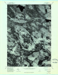
1977 Map of B Pond
USGS Topo · Published 1983About this map
B Pond and the high peaks of the Maine woods dominate this 1977 orthophoto quadrangle, capturing the wilderness of Oxford County just before the 1980s. This hybrid map uses rectified aerial photography to show the actual forest cover and timber management patterns surrounding Surplus Mountain. The hydrology of the region is clearly visible, with the Dead Cambridge River and Cambridge River carving through the heavy timber. Unlike traditional line-drawn maps, this photo-based survey reveals the specific density of the canopy and the exact path of the West Branch Ellis River as it flows through the southeastern section of the sheet. For those researching land use or hunting historical boundaries, the map provides a literal view of Greenwood Brook and the remote terrain as it appeared during the late seventies.
Find a feature on this map
6 named features on this map. Tap any name to fly to it.
Don’t see what you’re looking for? This feature index may not catch every label — zoom into the map to look around manually.
Map Details
Editions of this 1977 B Pond Map
2 editions found
Other maps of this area

1930 · Milan
USGS Topo · 1:62,500

1930 · Errol
USGS Topo · 1:62,500

1933 · Milan
USGS Topo · 1:62,500

1934 · Errol
USGS Topo · 1:62,500

1934 · Milan
USGS Topo · 1:62,500

1940 · Oquossoc
USGS Topo · 1:62,500

1942 · Oquossoc
USGS Topo · 1:62,500

1943 · Old Speck Mtn
USGS Topo · 1:62,500

1945 · Old Speck Mtn
USGS Topo · 1:62,500

1950 · Lewiston
USGS Topo · 1:250,000
Featured Places
- Upton, ME
- Grafton Township, ME
- Andover North Surplus Township, ME
- Andover West Surplus Township, ME
- Township C, ME