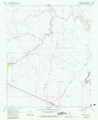
1968 Map of Babbitt Wash
USGS Topo · Published 1983About this map
Navajo Indian Reservation lands dominate the northern landscape of this quadrangle, where a complex network of seasonal drainages has carved through the Arizona plateau. The perennial character of the high desert is defined by features like Babbitt Wash, San Francisco Wash, and Padre Canyon, which weave together toward the Little Colorado River basin. Human infrastructure is anchored by the Atchison Topeka and Santa Fe railroad line, which bisects the territory alongside an extensive Pipeline corridor. The presence of the Reservation Tank and Reservation Well highlights the critical importance of water management for livestock and settlement in this arid environment. Other notable geographic markers include the deep incisions of Diablo Canyon and Yellow Jacket Canyon, while a Gravel Pit and various wells indicate the localized extraction and utility efforts in Coconino County during the late 1960s.
Find a feature on this map
17 named features on this map. Tap any name to fly to it.
Don’t see what you’re looking for? This feature index may not catch every label — zoom into the map to look around manually.
Map Details
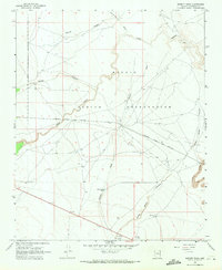
Editions of this 1968 Babbitt Wash Map
2 editions found
Other maps of this area

1886 · San Francisco Mtns
USGS Topo · 1:250,000

1891 · San Francisco Mtns
USGS Topo · 1:250,000

1894 · San Francisco Mtns
USGS Topo · 1:250,000

1899 · San Francisco Mtns
USGS Topo · 1:250,000

1947 · Flagstaff
USGS Topo · 1:250,000

1954 · Flagstaff
USGS Topo · 1:250,000

1958 · Flagstaff
USGS Topo · 1:250,000

1960 · Flagstaff
USGS Topo · 1:250,000

1962 · Flagstaff
USGS Topo · 1:250,000
1968 · Elliott Canyon
USGS Topo · 1:24,000