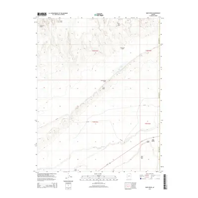
2014 Map of Baby Rocks
USGS Topo · Published 2014About this map
Comb Ridge dominates the central corridor of this Navajo County landscape, creating a striking geological spine that separates Little Capitan Valley from the surrounding high desert. The 2014 survey captures a region defined by its remarkable natural formations, including Ruin Arch, Hoola Hey Arch, and the spans of Swinnerton Bridge. In the northern reaches, Double Arch Canyon reveals the intricate erosion patterns characteristic of the Colorado Plateau. Settlement is concentrated at the small community of Baby Rocks, situated near the base of the massive Baby Rocks Mesa. Hydrological features are sparse but significant, with Laguna Cr winding through the southern townships and the seasonally fluctuating Dry Lake to the north. Transportation is anchored by Us-160, providing the primary modern access through this traditional expanse of the Navajo Nation.
Find a feature on this map
18 named features on this map. Tap any name to fly to it.
Don’t see what you’re looking for? This feature index may not catch every label — zoom into the map to look around manually.
Map Details
Editions of this 2014 Baby Rocks Map
This is the sole edition of this map. No revisions or reprints were ever made.
Other maps of this area

1883 · Marsh Pass
USGS Topo · 1:250,000

1892 · Marsh Pass
USGS Topo · 1:250,000

1892 · Canyon De Chelly
USGS Topo · 1:250,000

1952 · Agathla Peak 1 NW
USGS Topo · 1:24,000

1952 · Dinnehotso
USGS Topo · 1:62,500

1952 · Agathla Peak 1 NE
USGS Topo · 1:24,000

1952 · Agathla Peak 1 SE
USGS Topo · 1:24,000

1952 · Setsiltso Springs 2 NW
USGS Topo · 1:24,000

1952 · Setsiltso Springs 2 SW
USGS Topo · 1:24,000

1952 · Agathla Peak
USGS Topo · 1:62,500