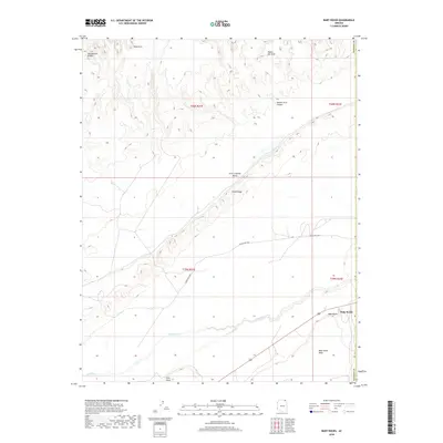
2018 Map of Baby Rocks
USGS Topo · Published 2018About this map
Comb Ridge dominates this high desert landscape, carving a sharp geological spine through the region and defining the eastern boundary of Little Capitan Valley. The settlement of Baby Rocks sits at the southeastern corner of the quadrangle, anchored by the towering Baby Rocks Mesa and the winding course of Laguna Cr. This modern 2018 survey highlights the remote nature of the Navajo Nation interior, where navigation depends on routes like Indian Rte 6460 and Indian Rte 6440. The map is particularly notable for its documentation of natural landmarks and indigenous features, including Ruin Arch, Hoola Hey Arch, and Double Arch Canyon, alongside the curiously named Swinnerton Bridge near the northwestern corner. These labels provide essential reference points for understanding the cultural and physical geography of this corner of the state.
Find a feature on this map
17 named features on this map. Tap any name to fly to it.
Don’t see what you’re looking for? This feature index may not catch every label — zoom into the map to look around manually.
Map Details
Editions of this 2018 Baby Rocks Map
This is the sole edition of this map. No revisions or reprints were ever made.
Other maps of this area

1883 · Marsh Pass
USGS Topo · 1:250,000

1892 · Marsh Pass
USGS Topo · 1:250,000

1892 · Canyon De Chelly
USGS Topo · 1:250,000

1952 · Agathla Peak 1 NW
USGS Topo · 1:24,000

1952 · Dinnehotso
USGS Topo · 1:62,500

1952 · Agathla Peak 1 NE
USGS Topo · 1:24,000

1952 · Agathla Peak 1 SE
USGS Topo · 1:24,000

1952 · Setsiltso Springs 2 NW
USGS Topo · 1:24,000

1952 · Setsiltso Springs 2 SW
USGS Topo · 1:24,000

1952 · Agathla Peak
USGS Topo · 1:62,500