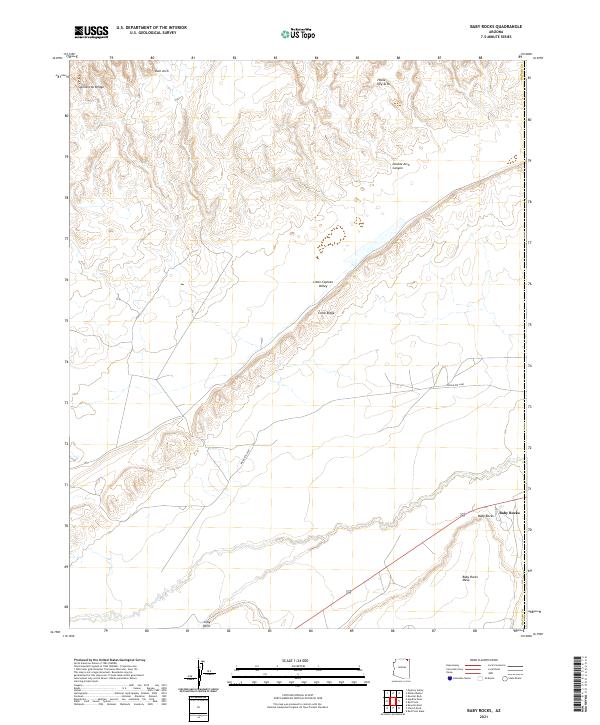
2021 Map of Baby Rocks
USGS Topo · Published 2021About this map
Baby Rocks sits at the base of the prominent Baby Rocks Mesa, serving as a focal point for this landscape in the Navajo Nation. The terrain is defined by the sweeping diagonal line of Comb Ridge, which cuts across the central portion of the quadrangle. This geologic formation separates the open Little Capitan Valley from the more intricate canyon country to the northwest. Landform names like Double Arch Canyon, Hoola Hey Arch, and Ruin Arch indicate a region shaped by erosion and perhaps early human occupation. Transportation through the area is primarily facilitated by Indian Rte 6460, which traverses the southern portion of the sheet. The map also identifies high points such as Gray Point and the natural feature known as Swinnerton Bridge near the northwestern boundary.
Find a feature on this map
15 named features on this map. Tap any name to fly to it.
Don’t see what you’re looking for? This feature index may not catch every label — zoom into the map to look around manually.
Map Details
Editions of this 2021 Baby Rocks Map
This is the sole edition of this map. No revisions or reprints were ever made.
Other maps of this area

1883 · Marsh Pass
USGS Topo · 1:250,000

1892 · Marsh Pass
USGS Topo · 1:250,000

1892 · Canyon De Chelly
USGS Topo · 1:250,000

1952 · Agathla Peak 1 NW
USGS Topo · 1:24,000

1952 · Dinnehotso
USGS Topo · 1:62,500

1952 · Agathla Peak 1 NE
USGS Topo · 1:24,000

1952 · Agathla Peak 1 SE
USGS Topo · 1:24,000

1952 · Setsiltso Springs 2 NW
USGS Topo · 1:24,000

1952 · Setsiltso Springs 2 SW
USGS Topo · 1:24,000

1952 · Agathla Peak
USGS Topo · 1:62,500