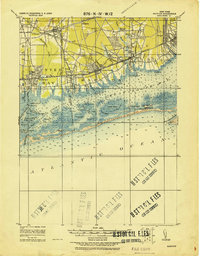
1919 Map of Babylon
USGS Topo · Published 1919About this map
Amityville, Lindenhurst, and Babylon anchor the southern shore of Long Island in this tactical survey by the Corps of Engineers. The map documents a landscape of transition, where established inland settlements like Farmingdale and Pinelawn connect to the coastal bays via the Long Island Railroad Montauk Division. Along the Great South Bay, the intricate network of marshy islands and inlets—including Gilgo Island, Muncie Island, and Oak Island—is meticulously detailed.
Find a feature on this map
79 named features on this map. Tap any name to fly to it.
Don’t see what you’re looking for? This feature index may not catch every label — zoom into the map to look around manually.
Map Details
Editions of this 1919 Babylon Map
This is the sole edition of this map. No revisions or reprints were ever made.
Other maps of this area

1897 · Hempstead
USGS Topo · 1:62,500

1897 · Oyster Bay
USGS Topo · 1:62,500

1898 · Hempstead
USGS Topo · 1:62,500

1898 · Oyster Bay
USGS Topo · 1:62,500

1899 · Hempstead
USGS Topo · 1:62,500

1900 · Oyster Bay
USGS Topo · 1:62,500

1901 · Babylon
USGS Topo · 1:62,500

1901 · Northport
USGS Topo · 1:62,500

1902 · Setauket
USGS Topo · 1:62,500

1902 · Fire Island
USGS Topo · 1:62,500