Loading...
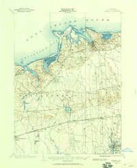
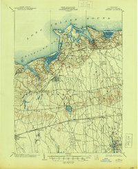
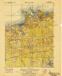
Loading map...1902 Map of Setauket
USGS Topo · Published 1959About this map
Port Jefferson and the surrounding north shore of Long Island define the character of this 1902 survey. The landscape is a mix of maritime activity and evolving inland settlements connected by the Port Jefferson Branch and the Long Island R. R.. While Setauket and Stony Brook occupy the bays of the Long Island Sound, the interior is dominated by agricultural townships and the early growth of Smithtown and Central Islip.
Find a feature on this map
52 named features on this map. Tap any name to fly to it.
Don’t see what you’re looking for? This feature index may not catch every label — zoom into the map to look around manually.
Map Details
Date Portrayed1902
Date Published1959
PublisherU.S. Geological Survey
Map TypeTopographic
Scale1:62,500
Physical Dimensions17 x 20.9 inches
Editions of this 1902 Setauket Map
This is the sole edition of this map. No revisions or reprints were ever made.
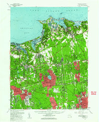
Historical Maps of Brookhaven Through Time
4 maps found
Featured Locations
Source Details
SourceU.S. Geological Survey
CopyrightPublic Domain