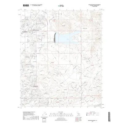
2018 Map of Bachelor Mountain
USGS Topo · Published 2018About this map
Skinner Reservoir serves as a dominant central feature in this Riverside County landscape, held by a significant dam structure at the head of Long Canyon. The surrounding terrain transitions from the developed neighborhoods of Murrieta and French Valley in the northwest to the more open, high-relief country dominated by Bachelor Mountain and Black Mountain. The map details a sophisticated water management network, including the San Diego Canal and the San Diego Aqueduct, which weave through valleys such as Auld Valley and Skunk Hollow. To the south, the landscape opens into Pauba Valley near the Temecula Creek drainage, while the presence of the Billy Joe Airport and various named residential tracks like Cll Sereno reflect the modern suburban and rural-residential character of the region.
Find a feature on this map
214 named features on this map. Tap any name to fly to it.
Don’t see what you’re looking for? This feature index may not catch every label — zoom into the map to look around manually.
Map Details
Editions of this 2018 Bachelor Mountain Map
This is the sole edition of this map. No revisions or reprints were ever made.
Other maps of this area

1901 · Southern California Sheet No. 1
USGS Topo · 1:250,000

1901 · San Jacinto
USGS Topo · 1:125,000

1901 · Elsinore
USGS Topo · 1:125,000

1901 · San Luis Rey
USGS Topo · 1:125,000

1903 · Ramona
USGS Topo · 1:125,000

1904 · Southern California Sheet No. 2
USGS Topo · 1:250,000

1904 · Southern California Sheet No. 1
USGS Topo · 1:250,000

1939 · Palomar Mountain
USGS Topo · 1:62,500

1942 · Temecula
USGS Topo · 1:62,500

1942 · Hemet
USGS Topo · 1:62,500