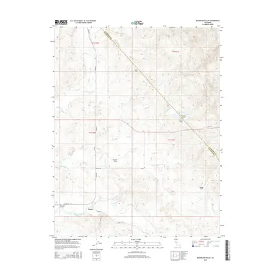
2015 Map of Bachelor Valley
USGS Topo · Published 2015About this map
Saint Joseph Cemetery anchors the southwest corner of this landscape near the community of Eugene, where the modern road network of E Sonora Rd and Twenty Eight Mile Rd meet. This terrain is defined by a dense network of seasonal drainages, including Littlejohns Creek and Rock Creek, which cut through the foothills of the Sierra Nevada. The boundary between Calaveras and Stanislaus counties runs diagonally across the topography, bisecting the drainage basins of Smith Cr and Hoods Cr. The southern portion of the map shows the influence of early agricultural water management through the presence of the Thalheim Lateral. In the more varied terrain to the northeast, features such as Buckham Gulch and Black Hill indicate the transition into the more elevated, dissected uplands typical of the gold country foothills.
Find a feature on this map
26 named features on this map. Tap any name to fly to it.
Don’t see what you’re looking for? This feature index may not catch every label — zoom into the map to look around manually.
Map Details
Editions of this 2015 Bachelor Valley Map
This is the sole edition of this map. No revisions or reprints were ever made.
Other maps of this area

1889 · Jackson
USGS Topo · 1:125,000

1892 · Jackson
USGS Topo · 1:125,000

1897 · Jackson
USGS Topo · 1:125,000

1902 · Jackson
USGS Topo · 1:125,000

1915 · Oakdale
USGS Topo · 1:31,680

1915 · Trigo
USGS Topo · 1:31,680

1915 · Thalheim
USGS Topo · 1:31,680

1916 · Bachelor Valley
USGS Topo · 1:31,680

1916 · Copperopolis
USGS Topo · 1:62,500

1942 · Farmington
USGS Topo · 1:62,500