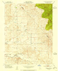
1953 Map of Bachelor Valley
USGS Topo · Published 1955About this map
The low-lying Bachelor Valley floor and surrounding foothills of Stanislaus County are defined by a network of seasonal watercourses and ranching history in the mid-1950s. The small settlement of Eugene serves as a local focal point near the Mt Diablo Base Line, supported by community landmarks like St Joseph Ch and Rosedale Sch. Large-scale water management projects are evident in the southwest corner with the Farmington Dam Flood Control Basin and its associated spillway, designed to regulate the flow of Littlejohns Creek.
Find a feature on this map
26 named features on this map. Tap any name to fly to it.
Don’t see what you’re looking for? This feature index may not catch every label — zoom into the map to look around manually.
Map Details
Editions of this 1953 Bachelor Valley Map
This is the sole edition of this map. No revisions or reprints were ever made.
Other maps of this area

1889 · Jackson
USGS Topo · 1:125,000

1892 · Jackson
USGS Topo · 1:125,000

1897 · Jackson
USGS Topo · 1:125,000

1902 · Jackson
USGS Topo · 1:125,000

1915 · Oakdale
USGS Topo · 1:31,680

1915 · Trigo
USGS Topo · 1:31,680

1915 · Thalheim
USGS Topo · 1:31,680

1916 · Bachelor Valley
USGS Topo · 1:31,680

1916 · Copperopolis
USGS Topo · 1:62,500

1942 · Farmington
USGS Topo · 1:62,500