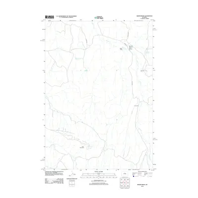
2012 Map of Bader Draw
USGS Topo · Published 2012About this map
Holland Winter Camp and Seaman Ranch represent the sparse human footprint in this high-desert landscape of Washakie County. The terrain is defined by complex drainage systems and the prominent Black Mountain, where water management is critical for the local ranching economy. This is evidenced by a network of catchments including Black Mountain Reservoir, V-W Reservoir, and Holland Reservoir. Seasonal watercourses like Nowater Cr, Buck Cr, and Mud Cr carve through the land, illustrating the hydrologic challenges of the region. Access to these remote sites is provided by primary ranching routes such as Nowater Rd and the aptly named Devils Slide Rd. The map also captures specific topographical features like Bader Draw and the uniquely identified Worland Nowood Draw Number 4, which mark the arid draws and washes of the Wyoming interior.
Find a feature on this map
14 named features on this map. Tap any name to fly to it.
Don’t see what you’re looking for? This feature index may not catch every label — zoom into the map to look around manually.
Map Details
Editions of this 2012 Bader Draw Map
This is the sole edition of this map. No revisions or reprints were ever made.
Other maps of this area

1952 · Rathbun Ranch
USGS Topo · 1:24,000

1952 · Battle Mountain
USGS Topo · 1:24,000

1952 · Bull Mountain
USGS Topo · 1:24,000

1955 · Arminto
USGS Topo · 1:250,000

1957 · Rathbun Ranch
USGS Topo · 1:24,000

1958 · Arminto
USGS Topo · 1:250,000

1960 · Packsaddle Creek
USGS Topo · 1:24,000

1962 · Arminto
USGS Topo · 1:250,000

1966 · Deadline Draw
USGS Topo · 1:24,000

1966 · Sand Point
USGS Topo · 1:24,000