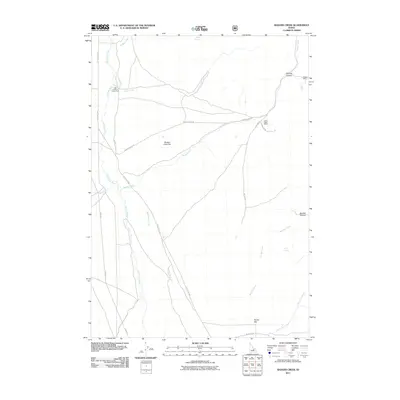
2011 Map of Badger Creek
USGS Topo · Published 2011About this map
Little Lost River drainage dominates this Butte County landscape, where the Little Lost Hwy follows the valley floor north through high desert terrain. The area is defined by its water sources and mining history, with the Badger Mine and Valley View Mine positioned along the eastern slopes of the quadrangle. The topography transitions from broad alluvial features like Badger Creek Bar and Sunny Bar to narrow, steep-walled passages such as Bunting Canyon and Boulder Canyon.
Find a feature on this map
24 named features on this map. Tap any name to fly to it.
Don’t see what you’re looking for? This feature index may not catch every label — zoom into the map to look around manually.
Map Details
Editions of this 2011 Badger Creek Map
This is the sole edition of this map. No revisions or reprints were ever made.
Other maps of this area

1955 · Dubois
USGS Topo · 1:250,000

1955 · Idaho Falls
USGS Topo · 1:250,000

1957 · Diamond Peak
USGS Topo · 1:62,500

1957 · Hawley Mountain
USGS Topo · 1:62,500

1958 · Dubois
USGS Topo · 1:250,000

1958 · Idaho Falls
USGS Topo · 1:250,000

1969 · Howe NW
USGS Topo · 1:24,000

1969 · Howe NE
USGS Topo · 1:24,000

1969 · Sunset Peak
USGS Topo · 1:24,000
1987 · Fallert Springs
USGS Topo · 1:24,000