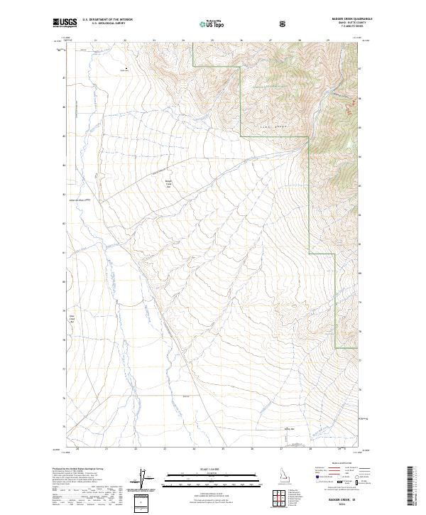
2024 Map of Badger Creek
USGS Topo · Published 2024About this map
The Little Lost River Valley forms the central character of this Butte County landscape, where the high slopes of the Lemhi Range descend into a wide corridor of high-altitude ranching and drainage. A distinct pattern of alluvial bars, including Badger Creek Bar, Deer Creek Bar, and Sunny Bar, marks the transition from the steep canyon mouths of the Challis National Forest to the valley floor. For local history and genealogy, Clyde Cem stands as a focal point in the northern section near Williams Creek. The map documents a complex water network essential to the region, featuring Big Spring Creek, Fowler Springs, and the seasonal flow of Boulder Creek. Transportation is anchored by the Little Lost River Hwy, which parallels the river and connects the scattered settlements and grazing lands of this corner of Idaho.
Find a feature on this map
26 named features on this map. Tap any name to fly to it.
Don’t see what you’re looking for? This feature index may not catch every label — zoom into the map to look around manually.
Map Details
Editions of this 2024 Badger Creek Map
This is the sole edition of this map. No revisions or reprints were ever made.
Other maps of this area

1955 · Dubois
USGS Topo · 1:250,000

1955 · Idaho Falls
USGS Topo · 1:250,000

1957 · Diamond Peak
USGS Topo · 1:62,500

1957 · Hawley Mountain
USGS Topo · 1:62,500

1958 · Dubois
USGS Topo · 1:250,000

1958 · Idaho Falls
USGS Topo · 1:250,000

1969 · Howe NW
USGS Topo · 1:24,000

1969 · Howe NE
USGS Topo · 1:24,000

1969 · Sunset Peak
USGS Topo · 1:24,000
1987 · Fallert Springs
USGS Topo · 1:24,000