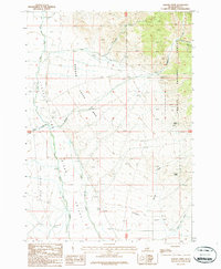
1987 Map of Badger Creek
USGS Topo · Published 1987About this map
Challis National Forest dominates the eastern landscape of this Butte County region, where the steep terrain of Bunting Canyon gives way to the broad alluvial fans of the Big Lost River Valley. During the late twentieth century, this area remained a landscape of resource extraction and seasonal grazing. Evidence of local prospecting is visible at the Badger Mine and the Valley View Mine, positioned near the forest boundary.
Find a feature on this map
20 named features on this map. Tap any name to fly to it.
Don’t see what you’re looking for? This feature index may not catch every label — zoom into the map to look around manually.
Map Details
Editions of this 1987 Badger Creek Map
This is the sole edition of this map. No revisions or reprints were ever made.
Other maps of this area

1955 · Dubois
USGS Topo · 1:250,000

1955 · Idaho Falls
USGS Topo · 1:250,000

1957 · Diamond Peak
USGS Topo · 1:62,500

1957 · Hawley Mountain
USGS Topo · 1:62,500

1958 · Dubois
USGS Topo · 1:250,000

1958 · Idaho Falls
USGS Topo · 1:250,000

1969 · Howe NW
USGS Topo · 1:24,000

1969 · Howe NE
USGS Topo · 1:24,000

1969 · Sunset Peak
USGS Topo · 1:24,000
1987 · Fallert Springs
USGS Topo · 1:24,000