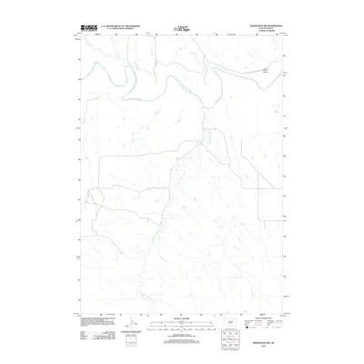
2012 Map of Badnation NW
USGS Topo · Published 2012About this map
The White River carves a winding path across this portion of Mellette County, defining the drainage patterns for several major tributaries. This rural landscape is characterized by its hydrological network, where White Thunder Cr flows northward to meet the main river channel. In the northeastern corner, the Valburg Ranch Airport stands as the primary marker of modern human infrastructure and aviation activity in this sparsely populated area. The terrain is further etched by smaller seasonal or intermittent flows like Bull Cr and Pitan Cr, which underscore the importance of water sources for local ranching operations. The road network follows the natural contours of the river valley, reflecting the traditional settlement patterns of the South Dakota prairie.
Find a feature on this map
5 named features on this map. Tap any name to fly to it.
Don’t see what you’re looking for? This feature index may not catch every label — zoom into the map to look around manually.
Map Details
Editions of this 2012 Badnation NW Map
This is the sole edition of this map. No revisions or reprints were ever made.
Other maps of this area

1951 · Murdo SE
USGS Topo · 1:24,000

1951 · Badnation
USGS Topo · 1:24,000

1951 · White River NE
USGS Topo · 1:24,000

1951 · Badnation NW
USGS Topo · 1:24,000

1955 · Martin
USGS Topo · 1:250,000

1958 · Martin
USGS Topo · 1:250,000

1970 · Vivian SW
USGS Topo · 1:24,000

1972 · Vivian SE
USGS Topo · 1:24,000

1982 · White River SE
USGS Topo · 1:24,000

1982 · Wood North
USGS Topo · 1:24,000