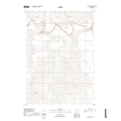
2017 Map of Badnation NW
USGS Topo · Published 2017About this map
The White River winds along the boundary between Jones and Mellette counties in this 2017 survey, carving a distinct corridor through the South Dakota plains. The map highlights a remote landscape defined by its drainages, including the southern reaches of Bull Cr and Bitan Cr which feed into the main river channel from the north. To the south, the expansive basin of White Thunder Cr dominates the terrain, illustrating the intricate erosion patterns typical of the region. Human presence is sparse, centered on the Valburg Ranch Airport near the river's northern bend. Rural access is maintained through routes such as Ironwing Rd and 258th St, which cross sections of the Public Land Survey System grid. This document serves as a detailed record of the mid-2010s ranching and natural geography in this section of the Great Plains.
Find a feature on this map
16 named features on this map. Tap any name to fly to it.
Don’t see what you’re looking for? This feature index may not catch every label — zoom into the map to look around manually.
Map Details
Editions of this 2017 Badnation NW Map
This is the sole edition of this map. No revisions or reprints were ever made.
Other maps of this area

1951 · Murdo SE
USGS Topo · 1:24,000

1951 · Badnation
USGS Topo · 1:24,000

1951 · White River NE
USGS Topo · 1:24,000

1951 · Badnation NW
USGS Topo · 1:24,000

1955 · Martin
USGS Topo · 1:250,000

1958 · Martin
USGS Topo · 1:250,000

1970 · Vivian SW
USGS Topo · 1:24,000

1972 · Vivian SE
USGS Topo · 1:24,000

1982 · White River SE
USGS Topo · 1:24,000

1982 · Wood North
USGS Topo · 1:24,000