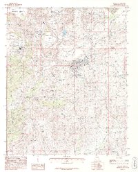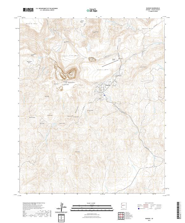
2021 Map of Bagdad
USGS Topo · Published 2021About this map
Bagdad and its surrounding desert uplands dominate this contemporary topographical study, where the town’s industrial and residential layout is defined by the winding Bagdad Rd. The community is anchored by the Bagdad School and the nearby Bagdad Airport, reflecting a concentrated settlement in a landscape of dramatic elevation changes. The town sits at the heart of a geological transition, surrounded by prominent landmarks like Sanders Mesa and Mesa Pass, with the industrial character further evidenced by the complex road network including Mine Shop Rd and Old Dick Rd.
Find a feature on this map
71 named features on this map. Tap any name to fly to it.
Don’t see what you’re looking for? This feature index may not catch every label — zoom into the map to look around manually.
Map Details
Editions of this 2021 Bagdad Map
This is the sole edition of this map. No revisions or reprints were ever made.
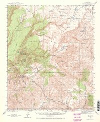
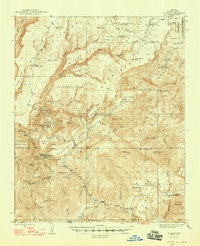
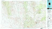
Historical Maps of Bagdad Through Time
8 maps found