
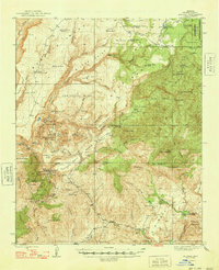
1948 Map of Bagdad
USGS Topo · Published 1948About this map
Bagdad and its surrounding mineral-rich mesas define this mid-century portrait of Yavapai County mining and ranching. The landscape is marked by a dense concentration of industrial sites, including the Hillside Mine, Copper King Mine, and Black Pearl Mine, illustrating the intense extraction efforts in the canyons of Boulder Creek and Copper Creek Mesa. These operations are connected by a network of winding roads and mountain passes, such as State Route 26, which linked the isolated copper and gold camps to the broader region. Outside the immediate industrial zones, the map documents a legacy of high-desert ranching at Bozarth Ranch and S H Ranch, set against a backdrop of complex terrain like Contreras Mesa and Sycamore Creek. This survey captures the transition of the area from a collection of scattered prospector claims into the more established mining community that emerged following the war years.
Find a feature on this map
86 named features on this map. Tap any name to fly to it.
Don’t see what you’re looking for? This feature index may not catch every label — zoom into the map to look around manually.
Map Details
Editions of this 1948 Bagdad Map
2 editions found
Other maps of this area

1887 · Prescott
USGS Topo · 1:250,000

1892 · Prescott
USGS Topo · 1:250,000

1903 · Congress
USGS Topo · 1:125,000

1904 · Congress
USGS Topo · 1:125,000

1923 · Signal
USGS Topo · 1:250,000

1942 · Signal
USGS Topo · 1:250,000

1945 · Bagdad
USGS Topo · 1:62,500

1947 · Sheridan Mountain
USGS Topo · 1:62,500

1947 · Camp Wood
USGS Topo · 1:62,500

1948 · Sheridan Mountain
USGS Topo · 1:63,360