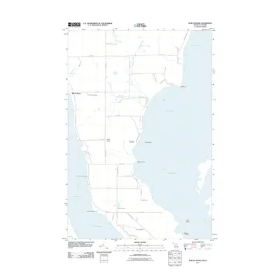
2011 Map of Baie de Wasai
USGS Topo · Published 2011About this map
Sugar Island and its surrounding waterways define this map, illustrating the complex geography where the Saint Marys River connects Lake Huron and Lake Nicolet. The settlement of Baie de Wasai on the island’s western shore serves as a primary reference point for researchers, with the Sugar Island Leading Light marking the nearby Little Rapids Channel. The interior of the island is crisscrossed by a grid of numbered roads, including E 6 Mile Rd and S Homestead Rd, which provide access to localized landmarks. Notable for genealogists are the scattered burial grounds that reflect the area's diverse heritage, such as the Bai-de-wasai Cemetery, the Finnish Cemetery, and the Wilwalk Cemetery. The map also captures several smaller landmasses, including Gem Island and Rock Island, positioned along the irregular coastline.
Find a feature on this map
56 named features on this map. Tap any name to fly to it.
Don’t see what you’re looking for? This feature index may not catch every label — zoom into the map to look around manually.
Map Details
Editions of this 2011 Baie de Wasai Map
This is the sole edition of this map. No revisions or reprints were ever made.
Other maps of this area

1913 · Sault Sainte Marie
USGS Topo · 1:62,500

1919 · Neebish
USGS Topo · 1:62,500

1941 · Neebish
USGS Topo · 1:63,360

1941 · Sault Sainte Marie
USGS Topo · 1:63,360

1951 · Barbeau
USGS Topo · 1:24,000

1951 · Baie De Wasai
USGS Topo · 1:24,000

1951 · Oak Ridge
USGS Topo · 1:24,000

1951 · Sault Ste. Marie
USGS Topo · 1:62,500

1951 · Sault Ste. Marie South
USGS Topo · 1:24,000

1951 · Payment
USGS Topo · 1:24,000