
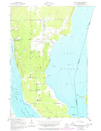
1951 Map of Baie De Wasai
USGS Topo · Published 1956About this map
Sugar Island sits at the maritime crossroads of the Great Lakes, where the Saint Marys River splits into the Middle Neebish Channel and Lake Nicolet. This mid-century survey reveals a community-centered landscape on the island, anchored by the settlement at Baie de Wasai and rural gatherings at the Town Hall and Farmers Hall. Education and faith are well-marked through the presence of Edison Sch, Hiawatha Sch, and churches like Sacred Heart Ch and Sts John and Anne Ch.
Find a feature on this map
31 named features on this map. Tap any name to fly to it.
Don’t see what you’re looking for? This feature index may not catch every label — zoom into the map to look around manually.
Map Details
Editions of this 1951 Baie De Wasai Map
2 editions found
Other maps of this area

1913 · Sault Sainte Marie
USGS Topo · 1:62,500

1919 · Neebish
USGS Topo · 1:62,500

1941 · Neebish
USGS Topo · 1:63,360

1941 · Sault Sainte Marie
USGS Topo · 1:63,360

1951 · Barbeau
USGS Topo · 1:24,000

1951 · Oak Ridge
USGS Topo · 1:24,000

1951 · Sault Ste. Marie
USGS Topo · 1:62,500

1951 · Sault Ste. Marie South
USGS Topo · 1:24,000

1951 · Payment
USGS Topo · 1:24,000

1951 · Lake George
USGS Topo · 1:62,500